
Setting The Standard in an Evolving Industry
Wilson & Associates is pleased to announce that we have joined SAM, a leading provider of geospatial data and services for utility, transportation, and infrastructure clients nationwide.
For more than three decades, SAM has helped clients plan, build, and maintain critical assets by combining advanced technology, deep expertise, and a client-focused approach. As part of SAM, Wilson & Associates will continue delivering the trusted service and technical capabilities clients rely on, now with the added strength of expanded resources, broader solutions, and a national platform.
OUR SERVICES
Skilled.
Thorough.
Efficient.
Download Wilson & Associates Packets
Information about our services, portfolio, industry standards and more!
We deliver precise construction surveying and staking, ensuring accurate layouts for efficient and successful project execution. Our team supports every phase of construction with detailed measurements and expert oversight.
DOT Route Surveying
We specialize in DOT route surveys, providing detailed mapping and analysis to support transportation infrastructure projects. We ensure all route designs are aligned with agency requirements and real-world conditions.
Data/Machine Modeling
Since 1996, we’ve offered data-rich modeling—from simple pads to complex interchanges—to enhance design accuracy and constructability. We tailor each model to your site and equipment, streamlining field operations from day one.
Utility Coordination
We expertly manage utility coordination, identifying conflicts early to streamline project timelines and reduce construction risks. Our proactive approach keeps stakeholders aligned and projects on schedule.
Subsurface Utility Engineering (SUE)
We use advanced techniques to locate and map underground utilities, mitigating risks and ensuring project safety. By following SUE standards, we deliver reliable utility data that saves time and budget.
BIM Modeling
We use Building Information Modeling to create detailed digital representations that enhance collaboration and project outcomes. Our models help catch issues before they reach the job site—saving time, money, and rework.
VDC Modeling
Through Virtual Design and Construction, we integrate models and processes to improve project visualization and efficiency. VDC bridges the gap between design and build, helping teams work smarter from start to finish.
Dimensional Analysis
We conduct precise dimensional analysis to ensure components meet specifications and align accurately within complex projects. Our experts verify tolerances with cutting-edge tools, helping avoid costly adjustments and delays.
Commercial/Industrial Construction
Our team works directly with owners, contractors, and developers to ensure every phase is executed with accuracy and accountability. From site prep to closeout, commercial and industrial construction projects demand speed, precision, and coordination across multiple disciplines.
Residential Construction Services
Reliable surveying and layout services for residential construction projects of all sizes. From initial land acquisition to market and throughout the entire residential project lifecycle, WA is a dependable partner committed to building communities with precision.
Boundary/ALTA/
Topographic Surveying
We offer boundary, ALTA, and topographic surveys to deliver the comprehensive data essential for land development and legal documentation. Our licensed surveyors ensure every line, easement, and contour is recorded with precision.
Platting
We provide expert platting services to facilitate land subdivision and development with accurate and compliant documentation. We guide clients through local requirements to ensure faster approvals and fewer revisions.
Terrestrial LiDAR Scanning
Terrestrial LiDAR Scanning delivers precise, high-detail data—ideal for renovations, retrofits, or tight construction sites. It captures complex environments quickly, supporting planning and design with minimal disruption.
Aerial LiDAR Scanning
Aerial LiDAR Scanning is a fast, efficient solution for capturing topographic and structural data on large or hard-to-reach sites. It enhances speed and safety while delivering reliable data for confident planning, design, and construction.
Mobile LiDAR Scanning
Mobile LiDAR Scanning captures accurate data across roads and corridors while in motion—ideal for highways, infrastructure, and utility mapping. It reduces field time, minimizes traffic disruption, and delivers fast, reliable results for planning and design.
Bathymetric LiDAR Scanning
Bathymetric LiDAR Scanning maps underwater and shoreline terrain using airborne, water-penetrating lasers. It’s a fast, safe way to gather elevation data in shallow-water environments—supporting design, permitting, and environmental analysis.

A 3D Look at 90 Years of Engineering
The High Definition Scan of the historic Wolf Creek Bridge in Cocke County, Tennessee, was a pivotal component in its restoration. Wilson & Associates utilized ground-based LiDAR technology to capture over 21 million data points, creating an accurate 3D model of the nearly 90-year-old structure. This comprehensive scan provided precise measurements for every aspect of the bridge, eliminating the need for repeated field visits and ensuring that the reconstructed components aligned perfectly with the existing foundations. The project culminated in the bridge’s reopening in February 2014, ahead of schedule and under budget, preserving its historical significance while enhancing its structural integrity.
PROJECTS
A Sample of Projects
I-65 Bridge Over the Cumberland River
TDOT’s I-65 Bridge Replacement project in Nashville is progressing under a Progressive Design-Build contract. Wilson & Associates completed pre-construction route surveying in just 25 days using a combination of traditional methods and terrestrial, aerial, mobile, and bathymetric LiDAR.
Reeds Vale,
College Grove, Tenn.
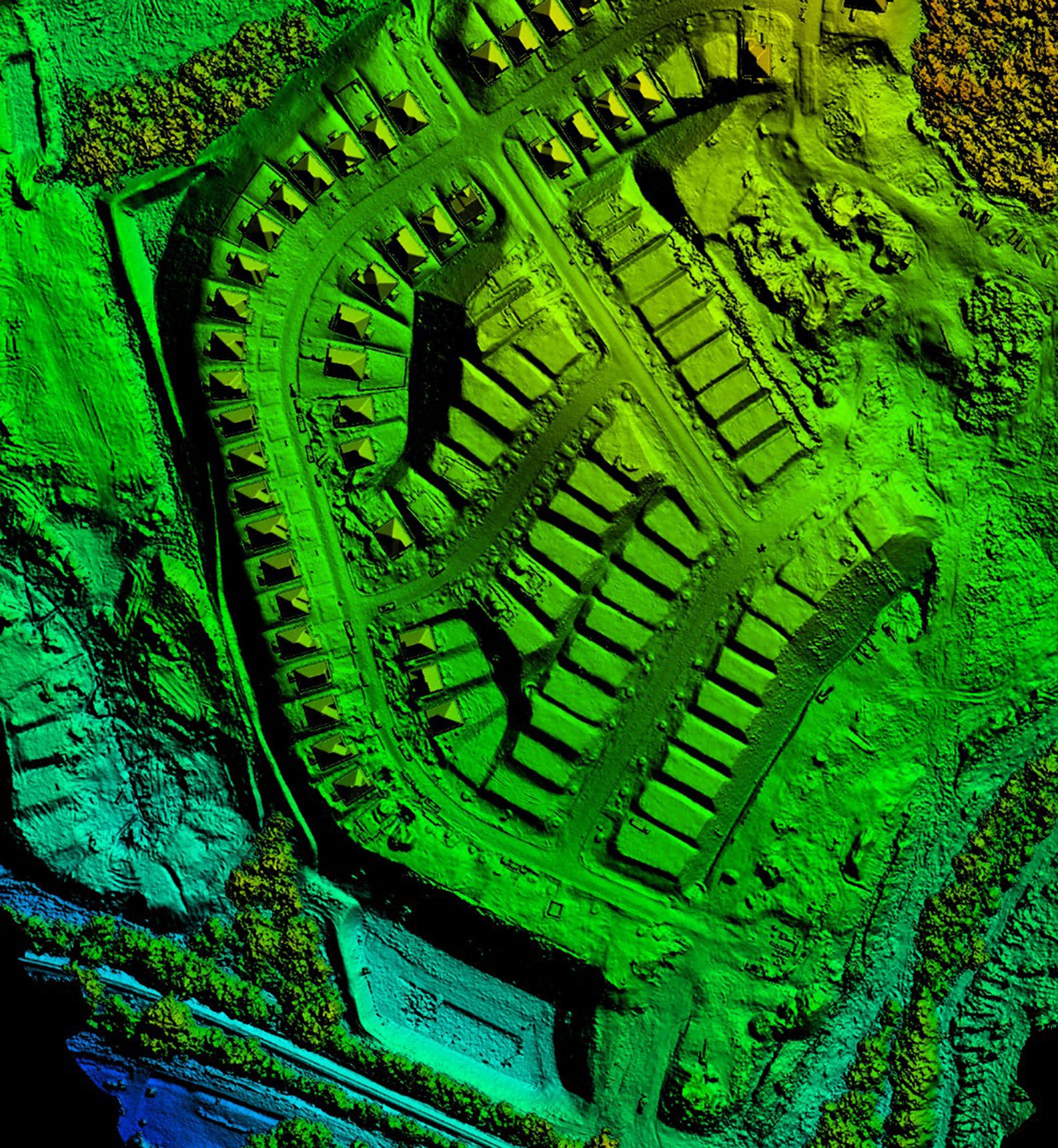
Reeds Vale brings together the full capabilities of WA’s Survey Design and Professional Surveying Services teams, including aerial and mobile mapping. From land acquisition to final platting, their collaboration delivers accurate, actionable data that supports early completion and fast delivery. This Signature Homes community in College Grove will feature 252 homes on one-third-acre lots, built in multiple phases.
SR-107/SR-81 Bridge
and Approaches
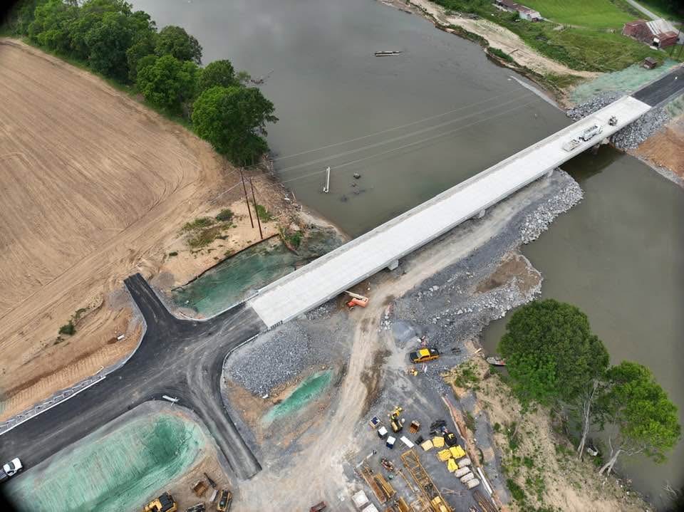
Wilson & Associates supported the emergency replacement of three Nolichucky River bridges with route surveying completed in just 13 days, using traditional and LiDAR methods. Construction staking services also helped accelerate project delivery.