Project Detail
TDOT BlueOval Project
TDOT BlueOval Project
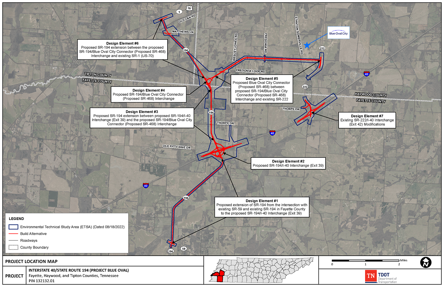
This project includes the construction of a new I-40 interchange, improvements to I-40, roadway extensions (south and north) of SR194, a new connector road (SR468) between existing SR222 and the SR194 north extension, and improvements to the existing SR222 interchange with I-40.
The timeframe and it being one of the first projects completed in OpenRoads Designer (ORD) are major contributing factors in HDR’s choice of WA to participate in this project. Sixteen months of traditional fieldwork were compressed into three months using WA’s aerial (UAS) LiDAR platform and in-house data processing. WA is one of the few companies with the ability to process LiDAR data in-house using their own professional staff, increasing the quality of the overall survey by allowing the route survey and LiDAR extraction departments to work simultaneously and QA/QC the data in real time.
Services provided included Traditional Route Survey, Aerial LiDAR Scanning, SUE Level A Utility Locating, Traffic Control, and Delivery of ORD Survey Files.
Location: Fayette County, Tennessee
Client: Tennessee Department of Transportation
Design Firm: HDR (serving as the primary consultant)