108 Beasley Drive
Franklin, TN 37064
Phone: (615) 794-2275
© 2025 Wilson and Associates
218 Suncrest Street, Suite 101, Johnson City, TN 37615
Phone: (615) 794-2275
139 Stout Street,
Cookeville, TN 38501
Phone: (615) 794-2275
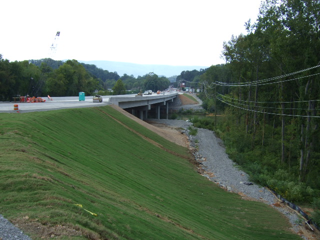
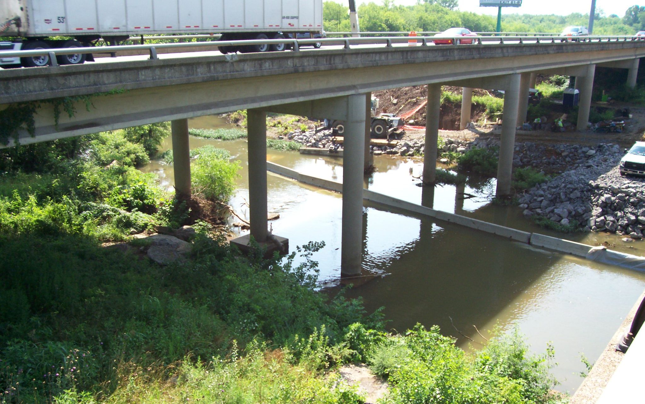
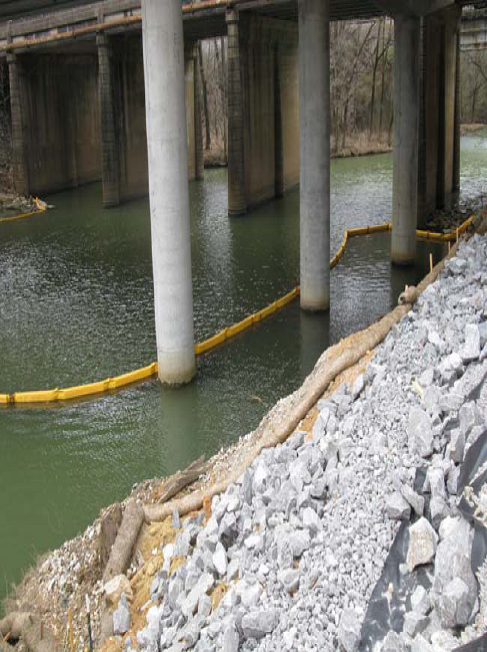
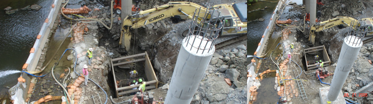
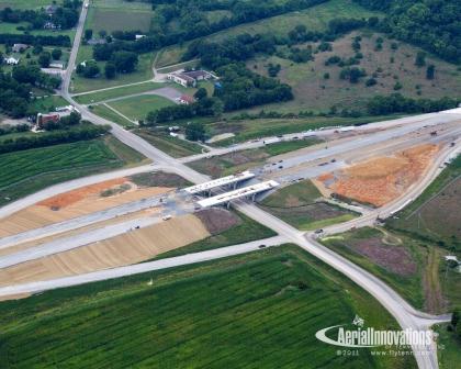
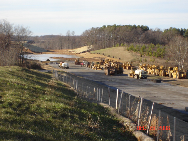
The project included the widening of 3.7 miles of I-24, widening of bridges over the Stones River and CSX Railroad, construction of a new SR-99 bridge over I-24, and construction of associated ramps, storm sewer, and curb and gutter. Project cost $38,000,000. W&A provided the Contractor’s EPSC inspection services including the Contractor’s Plan for Staging EPSC Operations, EPSC Inspection services relative to water quality, erosion and sediment controls, and water-resource-related permit compliance for the project, as well as coordination of the Contractor’s BMP installations to minimize environmental impacts.
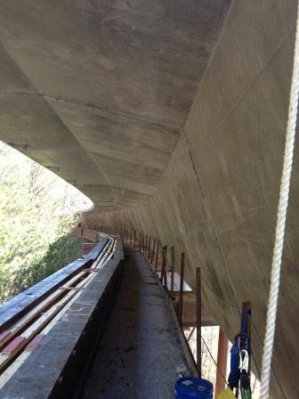
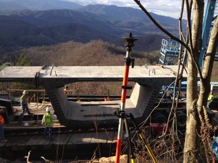
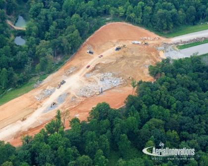
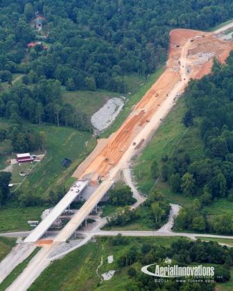
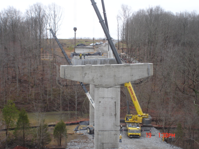
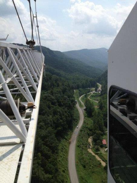
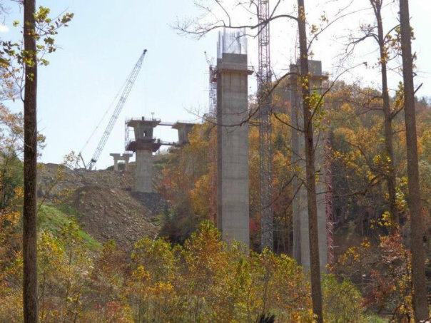
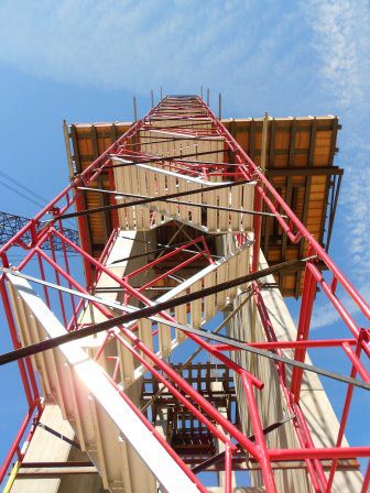
This project included the construction of a 900-foot precast, post-tension segmental bridge in the heart of the Appalachian Mountains in east Tennessee. The bridge has an curve geometry and an 11% sag vertical curve. Clearing limits for the project are limited to the area under the columns, and thus, the trees were topped under the deck. Additionally, the original ground under the bridge is steeper than a 1 to 1 slope.
Wilson & Associates’ duties were to lay out all precast pieces in the yard, perform as-builts for post castings and align the post-cast pieces for match casting. Also, our firm provided all layout for the field assembly of the structure and provided all geometry control for the design engineer. We serviced this project with two crews, along with a data engineer, for five to six days a week for two-and-a-half years.
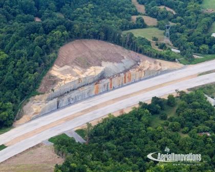
Wilson & Associates preformed the Engineering and Surveying subcontract and the Erosion and Sediment Control Supervision subcontract on three contiguous sections of improvements to I-75 North of Chattanooga, TN. Field adjustments were continuously kept up to date to make the new construction match existing conditions and all three of the projects finished on-time with no environmental issues.
The project, which included widening the section of I-75 from one mile south of Exit 11 to one mile north of Exit 11 to four lanes in each direction, also included the construction of new interstate bridges over Wolftever Creek and Lee Highway (SR-2/US-11) and major improvements to the interchange at Exit 11.
“To successfully complete a project of this magnitude is always a great accomplishment, but to do it early is even more impressive,” stated then TDOT Region 2 Director Bob Brown.
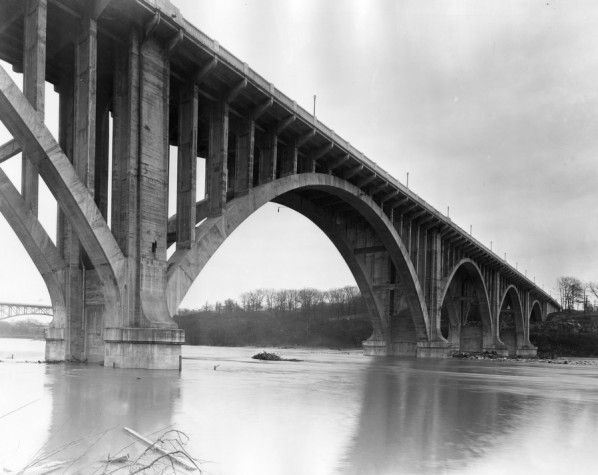
Henley Street bridge, originally completed in 1932, spans over 1800 feet across the Tennessee River in Knoxville, Tennessee. It was constructed out of cast-in-place concrete and was designed with 4 approach spans and 6 concrete arches anchored at the base of 7 piers. A total of 170 spandrel columns rose from the arches to support the roadway. Much of the structure did not conform to the original plans, however, Wilson & Associates, P.C. was tasked with providing data to build back the Henley Street bridge as it was originally constructed. Therefore, detailed as-builts would be necessary to calculate the required dimensions. Traditional survey methods could not achieve the accuracy needed for reconstruction and thus Wilson & Associates decided to use 3D-laser scanning for the as-builts.
This 3D-laser scanning process required setting an extremely accurate control network across the river and in the confines of a city environment. Once again, traditional survey methods would not achieve this requirement. Instead this precise control network was established using simultaneous occupations of 8 control points with Trimble GPS static receivers. These occupations were performed in the morning and evening and the results were post processed in Trimble Business Center. This gave us a reference network that was field verified with a maximum distance error of 1/8.
Once the reference network was established, we targeted the bridge with 24 3D-laser scanning targets. The targets were set at the base and top of each pier on the east and west side. The targeting involved 2 days of maneuvering with cranes on barges and john boats. The targets, comprised of 6″ diameter globes, were anchored into the concrete with red head concrete anchors.
A Leica C10 Scan Station was used to conducted a home scan of all 24 targets and 5 of the 8 control network points. Leica Cloudworx software performed a least-squared analysis of the home scan, allowing us to calculate the results to less than 1/8 for the entire network. Producing a home scan allows us to work in remote sections of the bridge utilizing only a few targets.
Over the next month, we scanned all sides of the arch, base and top of each pier and base of each spandrel bent. This produced a point cloud of over 21 million points of data that contained X,Y,Z values. Leica Cloudworx software was used to model the point cloud data and the model was transferred to Microstation for reduction to planimetric dimensions and elevations.
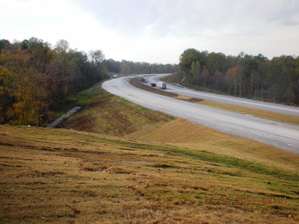
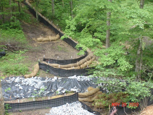
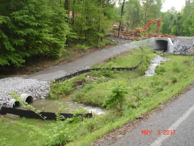
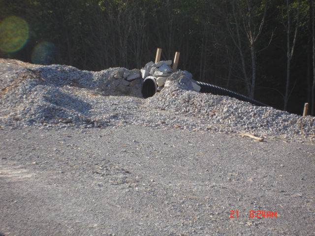
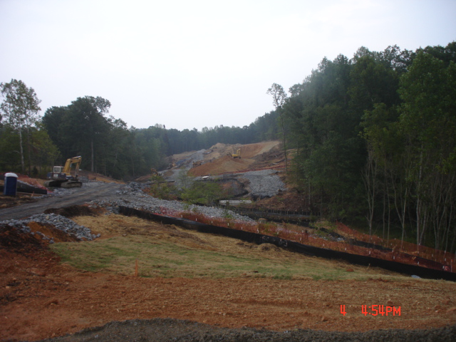
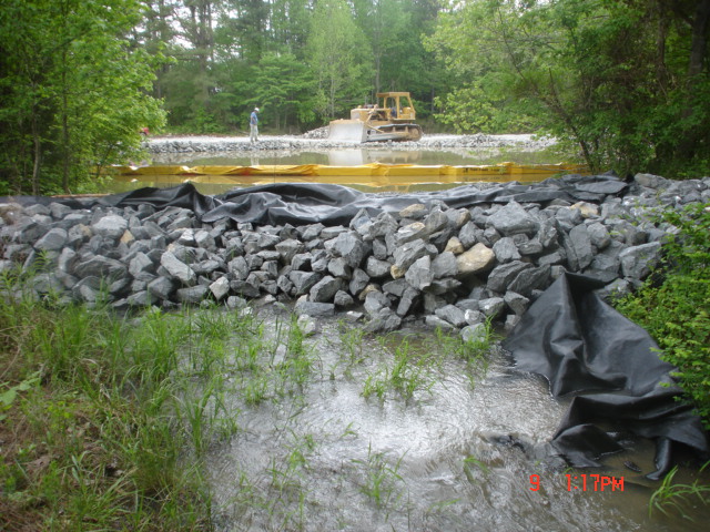
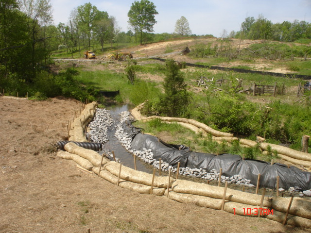
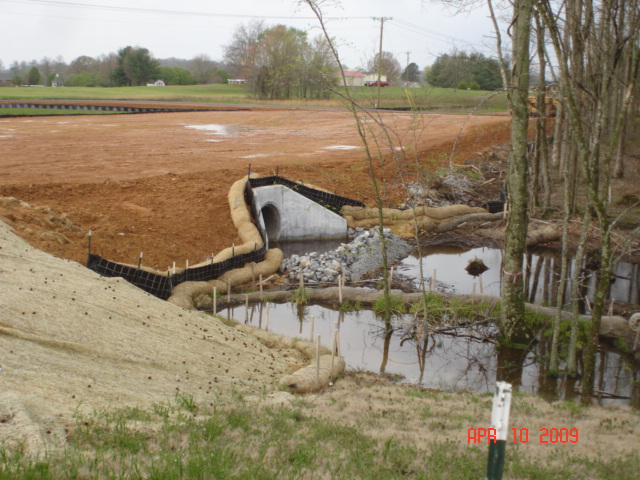
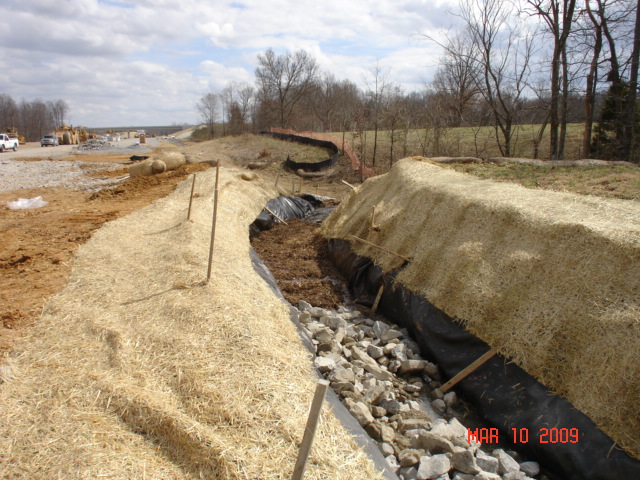
Wilson & Associates was awarded the subcontract for Environmental Oversight under TDOT Special Provision 209 Erosion Prevention and Sediment Control (EPSC) Supervisor. Under Wilson & Associates’ supervision, Grading Techniques with On ROW Stormwater Storage as the Primary BMP was used along with a Cooperative Team Approach which included all parties involved in the project. This resulted in both of these sections being completed and open to traffic in November 2012 without any significant environmental problems.
Wilson & Associates was also awarded the subcontract for Construction Stakes, Line and Grades. Wilson & Associates provided center-line staking, bridge abutment slope stakes, bridge pier staking and other staking prior to any initial clearing so that minimal clearing to install erosion prevention and sediment control measures could be achieved.
This project became the basis for Erosion Control Design on succeeding Tennessee Department of Transportation New Alignment Projects.
Bell & Associates Section 2 & 3 of SR 840
In June 2002, the Tennessee Department of Transportation (TDOT) let to contract the 6.5 mile section of SR-840 from SR-100 to SR-46. Later that year, site inspections by the Tennessee Dept. of Environment and Conservation (TDEC), some of which were due to citizens complaints, found large areas of disturbed ground, major sediment releases into streams and tributaries, and either improperly installed EPSC measures or a lack of EPSC measures. The department received Notice of Violations on the project and the construction project was halted. TDOT was ultimately fined $800,000. Against this background TDOT made numerous design changes to the 840 segment between SR-100 and Pinewood Road in an attempt to minimize impacts to the environment. The section was re-let to contract in July 2007.
Wilson & Associates was awarded the subcontract for Environmental Oversight under TDOT Special Provision 209 Erosion Prevention and Sediment Control (EPSC) Supervisor. Under Wilson & Associates’ supervision, two new concepts for EPSC efforts were initiated: The First – a “Cooperative Team Approach” which included all parties involved in the project was used and the Second – an intense use of “Grading Techniques” and on ROW stormwater storage. This resulted in this section being completed and open to traffic in October 2010 without any significant environmental problems.
Wilson & Associates was also awarded the subcontract for Construction Stakes, Line and Grades. Wilson & Associates provided center-line staking, bridge abutment slope stakes, bridge pier staking and other staking prior to any initial clearing so that minimal clearing to install erosion prevention and sediment control measures could be achieved.
This project became the basis for restructuring the environmental measures on all succeeding Tennessee Department of Transportation Projects.
Highways, Inc. Section of SR 840
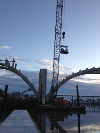
VDOT’s design-build contract for the Route 460 Connector Phase I in Buchanan County was awarded to Bizzack Construction, LLC., Lexington, Ky. in August 2009. Construction began spring 2011. C J Mahan the bridge subcontractor retained Wilson & Associates to provide complete construction engineering and surveying services for the two cast-in-place segmental arch bridges.
The Route 460 Connector Phase I includes design and construction of:
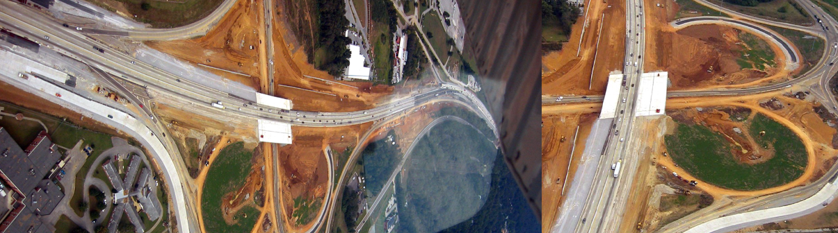
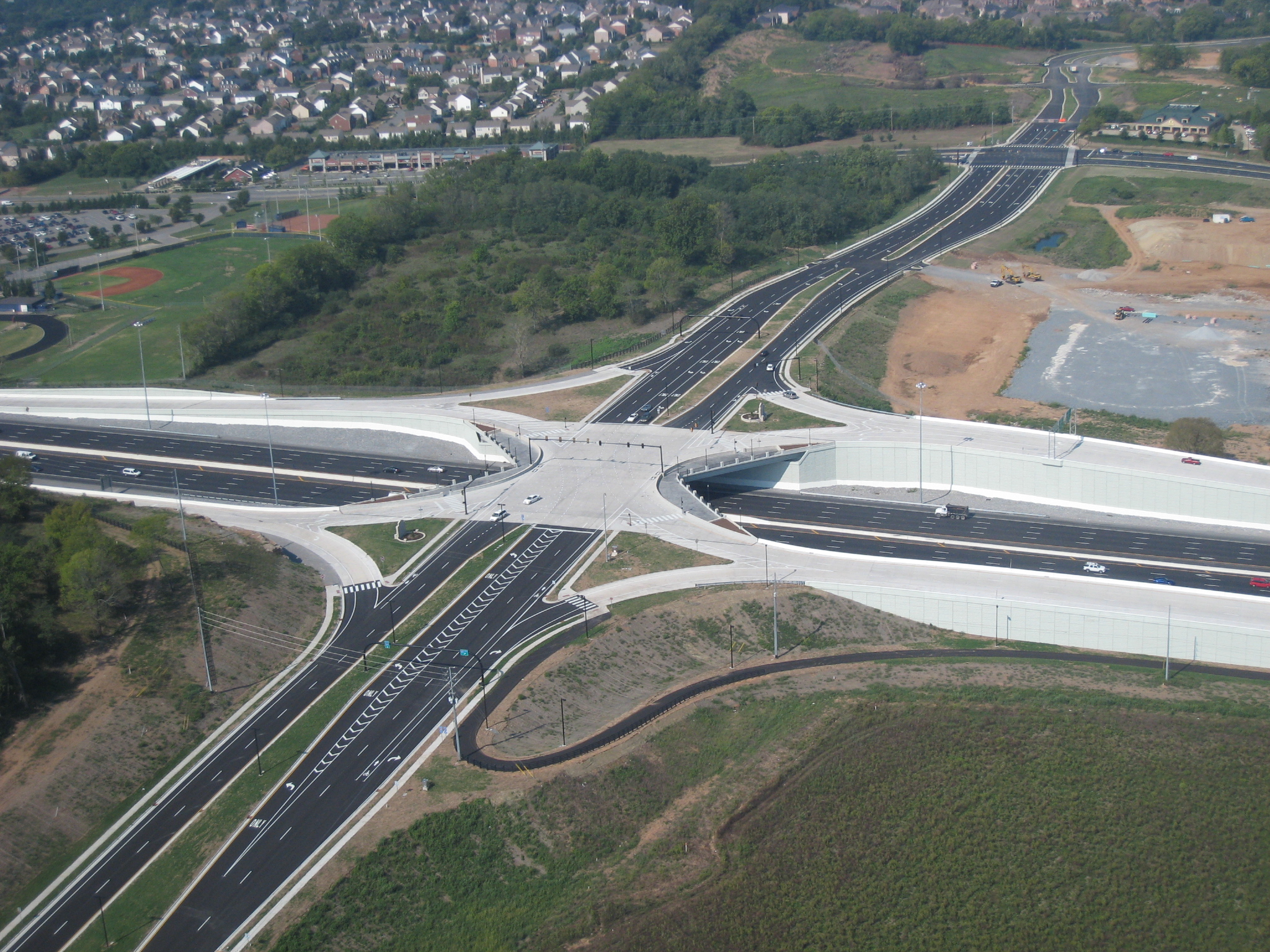
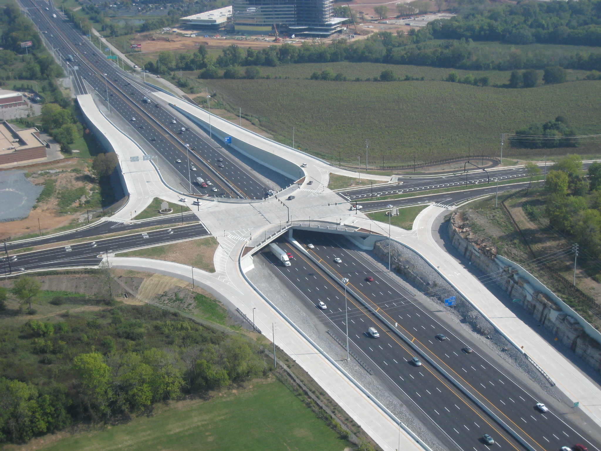
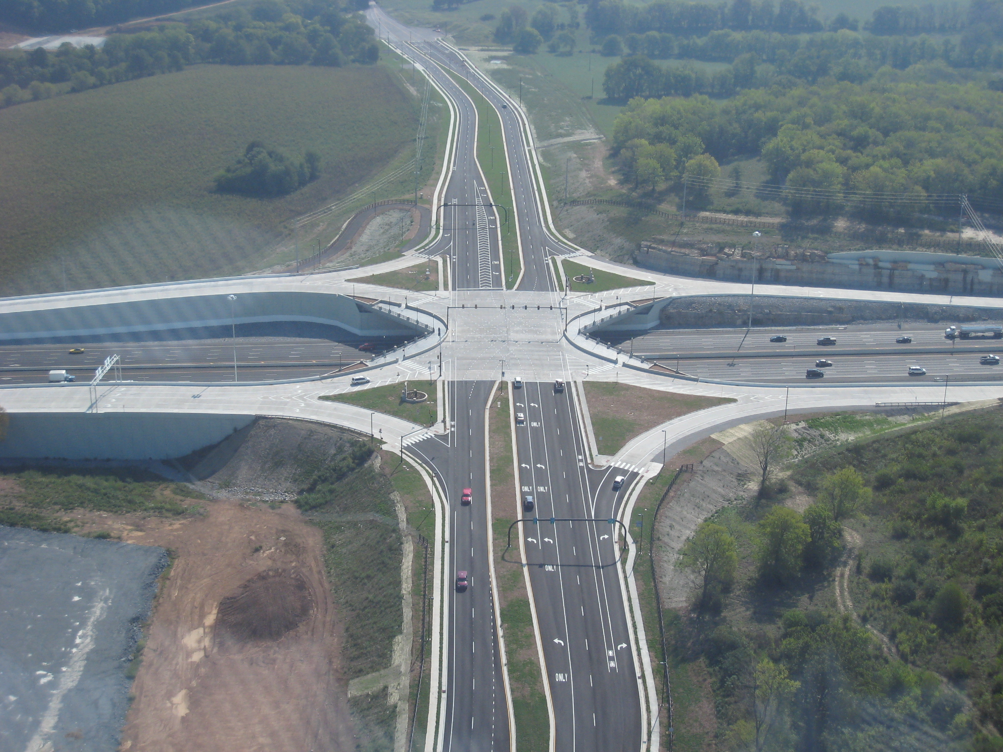
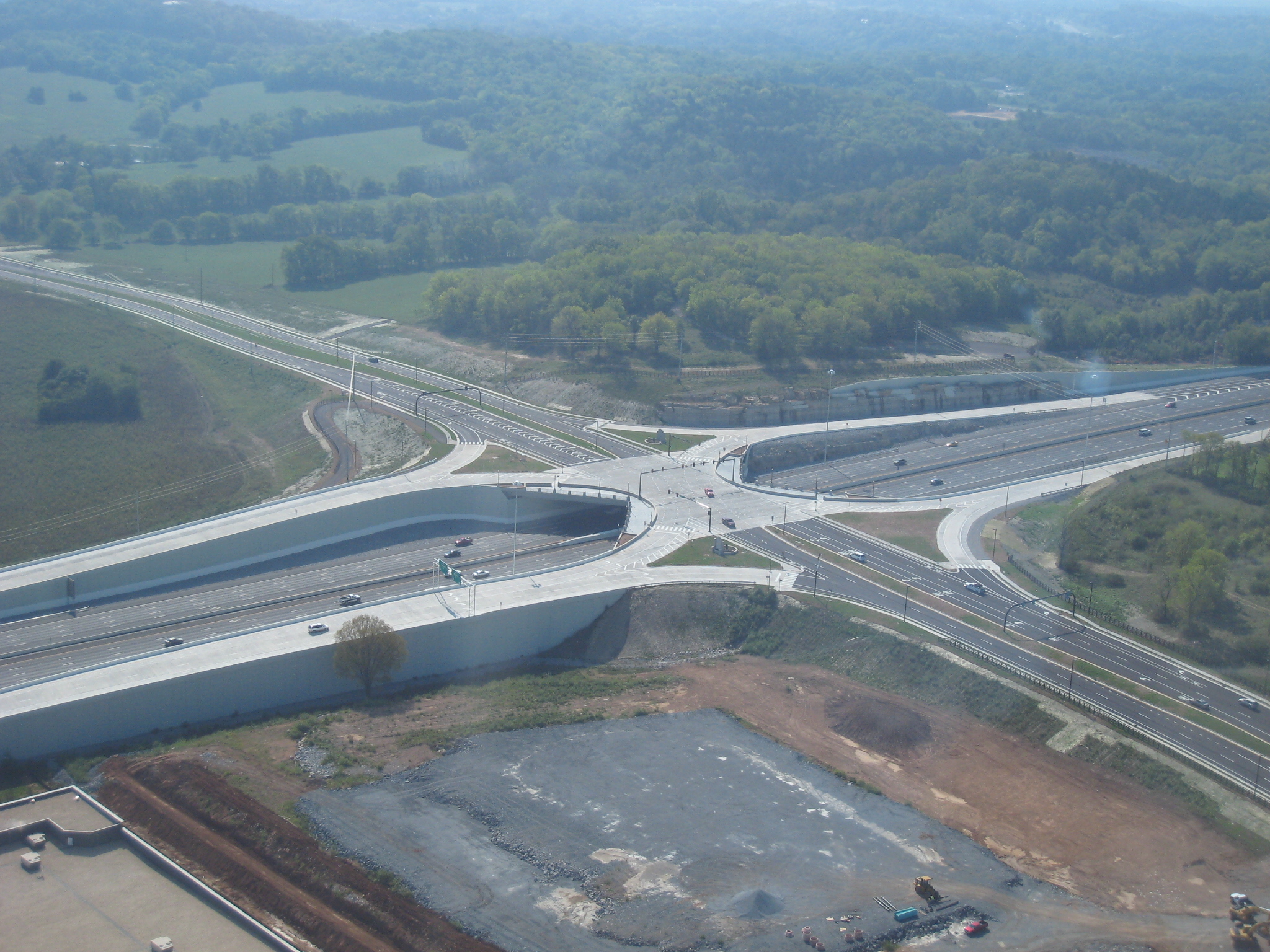
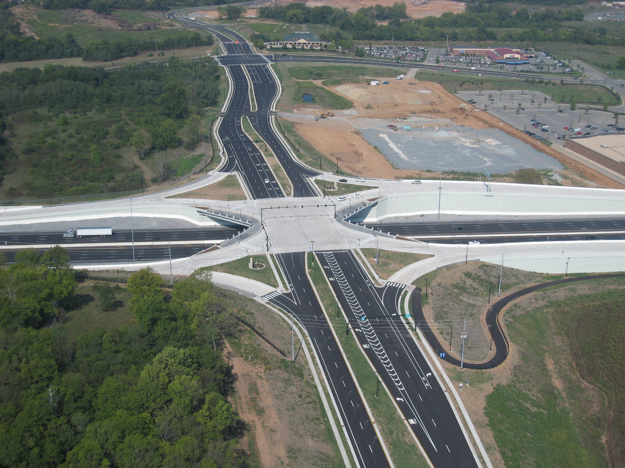
This project included a Single-Point Urban Interchange design where all traffic movements are initiated at one large intersection controlled by one traffic signal. When the traffic signal turns green, opposing traffic moves quickly through the intersection. Surveying and engineering for an intersection where all traffic movements are aligned to intersect at a single point is complicated and the elevated structure required for McEwen created an even greater deal of geometric complexity. Each freeway exit and entry ramp approaches and crosses the bridge with curved alignments. Construction stakes, lines and grades were also required for sidewalk plazas that include landscape planters, colored and stamped concrete, decorative metal pedestrian railings and 19th century-style lighting fixtures.
“I want to congratulate Wilson & Associates for a job well done. They worked diligently through one of the hottest summers on record to help us deliver this project ahead of schedule.”
Rick Turner, Vice President Rogers Group, Mid-Central Division